Welcome to Life Images by Jill

Welcome to Life Images by Jill.........Stepping into the light and bringing together the images and stories of our world. I am a photographer, writer and multi-media artist.
Focussing mainly on Western Australia and Australia, I am seeking to preserve images and memories of the beautiful world in which we live and the people in it.

Welcome!

Welcome!
PLEASE CLICK ON THE IMAGE TO GO TO MY RED BUBBLE STORE.
Showing posts with label Mulla Mulla. Show all posts

Sunday, 15 December 2024

Midwest, Goldfields, Wildflowers Trundle - Part 6 - Niagra Dam & Karalee Rock - Western Australia

 Hello dear blogging friends. I hope you and yours are doing well. I thought before the year finishes I better finish off our Wildflower-Midwest-Goldfields Trundle. But I see now there is going to be two posts to finish this off. If you didn't see the last post you can revisit here - Part 5 - Leonora, and Gwalia, Western Australia

We are going to be free camping for the next few nights. Here is the map again - we have just left Leonora and are heading south through the goldfields area towards Niagra Dam and then passing through Kalgoorlie to Karalee Rock on the Great Eastern Highway before turning north to Beringbooding and Elachbutting Rock before returning home via Bruce Rock. 

Niagara Dam is located about 83 kilometres south of our last stop, Leonora, and 191 kms north of Kalgoorlie via the Kookynie Road. It is a great place to stop for a picnic, or to free camp overnight or for a few days. We discovered this little oasis years ago and have camped here several times. There are plenty of places to set up camp and we have found it to be a quiet camp. As we didn't have a long way to go from Leonora, we had a lazy get up and arrived at Niagra before lunch-time. 

The 30,000,000 gallon Dam was built in 1897 with cement hauled on 400 camels from Coolgardie by the Afghan cameleer Abdul Waid. The Dam was to provide water for the now abandoned goldmining town of Niagara, the surrounding district, and for the steam locomotives using the railway linking Kalgoorlie, Menzies and the northern goldfields. John Alway pegged the first gold lease in the Niagara area in January 1895, followed rapidly by other mining leases.

Underground water was found at Kookynie soon after Niagara Dam was completed, and the Dam proved unreliable due to intermittent rainfall.  Named after a nearby waterfall which proved to only flow after heavy rain, Niagara was a little different to its gigantic namesake.

There are two walk trails – the Round the Dam Trail (1150 metres) and the Breakaway Trail (1600 metres). The walks are relatively easy and are well marked with steel marker posts approximately every 70 metres letting you explore and learn about the landscape through the interpretive panels. The path takes you across the dam wall - no jumping or diving. 

These rocky outcrops are called breakaways - Breakaways are a notable feature of inland Western Australia. Softer soils have gradually eroded through the repeated action of wind and water. Only those areas with a hard laterite (ironstone/granite) top have resisted this reshaping erosion.


There was a gorgeous display of the Tall Mulla Mulla - Ptilotus exaltatus which is prolific through midwest and northern Western Australia. It always signals to me when we travel north that we have travelled out of the south west. They are one of my favourites. There are around 100 varieties of Mulla Mulla. I have added a few more to my photo list since I wrote this post in 2017. 


And some birds - we think the one on the left is the Grey-headed honeyeater and on the right is the Cockatiel weiro (often a household pet as it responds well to people). 

It was a beautiful still, quiet night and we toasted marshmallows over our campfire. 

The next morning we headed south to Kalgoorlie, passing through Menzies around 60kms from Niagra Dam. There is an interesting story to read on my blog about the Menzies Town Hall clock here - Menzies - Town hall without a clock. As you can see it now has a clock - but didn't have for around 100 years. 


We only stopped in the gold mining town of Kalgoorlie briefly before heading west to our next stop Karalee Rock - around 372km from Niagra Dam - arriving early afternoon. 

Located not far off the Great Eastern Highway 177 km west of Kalgoorlie, we have camped at Karalee Rock several times over the years, and it is one of my favourite free camps.  We decided to stay for two nights. 

There is plenty of places to set up with lovely shady camp sites suitable for caravans, camper trailers and tents. The only disappointment was that the toilets weren't operating. It is a popular site to camp so I hope they fix them soon. 

There are walk trails around and over the rock. And plenty of opportunity to take photos of wildflowers, including orchids in season. Orchids can particularly be found in the rock gardens were water collects on the rock. We enjoyed pointing some of these tiny orchids out to some other visitors to the rock. 

Below you can see, clockwise from top left - Thelymitra antennifera - Lemon scented sun orchids (I love their little faces), we think is the blue Cyanicula amplexans – Dainty Blue Orchid, Prasophyllum gracile - Little Laughing Leek (so tiny), and the Caladenia roei - Clown orchids (I love their stripy trousers). 

Karalee Rock is one of the stopping points along the Golden Pipeline Heritage Trail which follows the 560 kilometre Perth to Kalgoorlie pipeline, and is one of a number of rain water rock catchments built in the 1890s to service the steam trains on the Eastern Railway from Perth to the Goldfields. The rock's history goes back thousands of years to when Aboriginal people camped here and collected water from the rock’s gnamma holes and soaks.

When the railway between Southern Cross and Kalgoorlie was completed in 1896 a series of rock walls, an aqueduct and 48.3 million litre dam was constructed at Karalee to collect rain water off the two granite rocks and provide water for steam trains en route to Kalgoorlie. 

Six kilometres of granite slab walls up to a metre high, all cut from the rock itself and laid by hand, surround Karalee Rock forming a rain catchment. 

These walls direct rain water to flow off the rock into the dam via a large semi-circular steel flume aqueduct, which was hand riveted at each joint.  The water was then pumped 3.6 kilometres south to the railway siding. The construction was an enormous achievement of both manual labour and horsepower.  


And more wildflowers - it really is a lovely place to stop and relax, walk or just sit and read under the shade. 


You often see Ornate Dragon lizards darting across granite rocks - you need to be quick to get their photo


And last year when we were camped at Karalee we came across a Tiger Snake slithering across the rock. Deadly poisonous - you don't want to get tangled up with one of these. Stand still and back away slowly.


I hope you have enjoy this part of our Midwest, Goldfields and Wildflowers Trundle. Next time I will take you to Beringbooding and Elachbutting Rocks for the final part of our tour. 

These are free camping spots with basic facilities, be self-sufficient: gas BBQ, fire rings, bins, long-drop toilets, chemical toilet dump point. Bring own firewood and be aware of fire bans. Please be respectful of other campers. Please take away your rubbish. 

You might also like:


Thank you so much for stopping by. I hope you are enjoying my continuing tour.  I value your comments and look forward to hearing from you. I will try to visit your blogs in return. Have a wonderful week.
 
I am linking up to the link-ups below. Please click on the links to see fabulous contributions from around the world - virtual touring at its best!
   

Sunday, 10 November 2024

Midwest Goldfields Wildflower Trundle - Part 4 - Yalgoo and Sandstone

 Hi all, I hope you and yours are doing well. Today we continue with Part 4 of our Midwest Goldfields Wildflower trundle. 

After our stay at Wooleen Station, we returned south to Mullewa and then turned east on the Geraldton Mt Magnet Road. I thought at this point I should show you the map again. The next part of our journey is Mullewa to Sandstone - 396km.


There were lots of mining trucks on the road going east. You really need to be careful on the road, especially if wanting to overtake. We reached Yalgoo around 10am


and visited another one of Monsignor Hawes' churches - the Dominican Chapel of St Hyacinth Holy Trinity Church built during 1920-22 for the Dominican Sisters who were brought to Yalgoo to run a school. The chapel was the smallest church designed by Hawes. It was restored by Shire of Yalgoo in 1980. Unfortunately you can only view the church from the outside. The chapel is a small and simple structure in Inter-War Romanesque style, with a terracotta roof and masonry and timber framed bell tower, and is all that remains of a larger complex of buildings. The chapel contains examples of Hawes’s handmade arts and crafts influenced artworks.

Local carpenter Hendry Jermy built the convent school. Most of the materials came from the old convent in the near-derelict town of Day Dawn near Cue. The school opened in February 1922 with 23 students and ran till 1950. Two stone chimneys which you can see in the foreground are all that remain of the school which was dismantled and used to construct a shearing shed on a nearby property. 


After having lunch and fuelling up in Mt Magnet, we continued east towards Sandstone. Along the way we stopped to take photos of the magnificent Royal Mulla Mulla - ptilotus rotundifolius which grows from 60cm to 2 metres and has huge fluffy flowers.  It occurs naturally in the drier regions of Carnarvon, Gascoyne, Little Sandy Desert, Murchison and the Pilbara in Western Australia.


There were still lots of mining trucks on the road. We arrived in Sandstone late afternoon and booked into the Alice Atkinson caravan park. We have stayed here before - it is very quiet and well presented. We were hoping the hotel would be open for dinner, but sadly it is closed down. The community wanted to buy it but the asking price was too much. However the café located in the old post office and telegraph building is open for breakfast and lunch. 


We had two nights in Sandstone - so we made the next day our exploring day. After pancakes for breakfast and doing the washing and a bit of cleaning in the van we explored the Heritage Drive, which only takes half a day. We had visited the Visitor Centre the day before and picked up maps and information. 

Prior to the arrival of Europeans the area was the home to the Wongi and Yamagee peoples. The first European into the area was John Forrest in 1869. The goldrushes of the 1880s led to the opening up of the Murchison area. In 1894 prospector Ernest Shillington discovered gold about 20km south of the present day Sandstone. The town was officially gazetted in 1906. Between 1906-1912 the town had a population of between 6000-8000, and the town had 4 hotels and 2 banks. The railway line reached town in 1910. The town's decline coincided with the outbreak of WW1 in Europe. Many miners left to serve overseas. Many never returned and others, seeing the declining fortune of mines, drifted away from the area. By 1919 the population was only 200. 

Today it is a small centre for the surrounding pastoral leases and stopover for tourists and gold prospectors.   (info with thanks from the Sandstone Visitor Centre) 

The heritage Trail includes locations around town, as well as a leisurely 18km marked self-guided Heritage Drive. Head out of town on the Paynes Find Road and then turn onto Menzies Road. 

First stop is Contradiction Well, built by the State Government during the gold rush years around 1900. Sunk by hand to 100 metres, and water brought to the surface by windlass and bucket, it produced good drinking water for many years. 


Next stop is the former State Battery which is listed on the State Register of Heritage Places. The battery operated between 1908 and 1982, providing an invaluable service to small mines and prospectors in the area. 


Next stop is London Bridge, a weathered basalt ridge thought to be 350 million years old. The bridge is the result of different rates of erosion in hard and soft rock. The underlying rocks of the Sandstone area are thought to be 2 billion years old. A popular picnic place for locals, the bridge is growing thinner and may eventually collapse, so people are asked not to climb the bridge. 

The wildflower you see in the foreground of the above collage is one of the mulla-mulla varieties - Silver Mulla Mulla Ptilotus obovatus


Overnight camping is not permitted, but they do have ingenious BBQs


Next stop is the Old Brewery, constructed by Irishman JV Kearney in 1907. The main building was on top of a breakaway about 1015 metres high. Water from a well was pumped to an elevated tank and from there gravitated to the coolers and down to the brew vats. The beer then flowed via pipes to the cellar built into a tunnel driven into the face of the breakaway. The underground cellar kept remarkedly cool even in the hottest weather by means of a winze - a hole bored through the ceiling of the rock. The brewery continued until 1910 when beer was brought to Sandstone by rail from Mt Magnet. 


From here the trail takes you back to Agnew Road and back into town. Our next stop was the old cemetery on Meekatharra Road. The first burial was in March 1908, a 10-month old baby named Horace Mahood. The last burial was Samuel Ure who died when the Oraya Mine collapsed on 25 April 1932. However his body was not recovered until the mine reopened in 1995, and he was laid to rest in the cemetery on 1 October 1995. 

There are 141 known grace sites in the cemetery. What we found very interesting was that volunteers from Outback Graves.org have put plaques with names and details onto many of the graves, making it very interesting, especially the cause of death. You can find a lot of very interesting information on their site. You can find out a lot visiting old cemeteries. 


Back in town we had lunch at the Sandstone Old Post Office Cafe (I recommend you stop by for a cuppa or a meal) and looked at their interesting historic displays, viewed a historic photo exhibition in the Town Hall, spoke to the ladies at the local craft group, visited the Heritage Museum in the Visitor Centre, got a key so we could go into the Black Range Chapel to see their stained glass windows depicting flora and fauna, visited the war memorial, looked at the old Police Station lockup, checked out the painted water tanks, and viewed from the street the National Hotel - sadly now closed - we had dinner here last time we were in Sandstone. 


If you are a golfer you can hire golf clubs from the Visitor Centre. You can also visit the Gold and Wool Interpretive Park and learn about mining and pastoral history. 

Sandstone has an Astrodome located in the old school grounds, and viewings are conducted between April and October at 7.30pm subject to the weather. Bookings essential from the Visitor Centre. 

I hope you have enjoyed this little tour of Yalgoo and Sandstone. It is a relaxed and interesting stop over for a day or two. Next time I will be back with the next part of our journey. Thankyou to the Shire of Sandstone for the information in this blog post. 

Sandstone is located 742 km north east of Perth via the Great Northern Highway and then the Geraldton Mt Magnet Road. The Shire of Sandstone covers an area of 32,605 square kilometres with a population of around 116. But it has a huge community spirit. 

More information at: sandstone.wa.gov.au  and Yalgoo 

and Monsignor Hawes churches

Thank you so much for stopping by. I value your comments and look forward to hearing from you. I will try to visit your blogs in return. Have a wonderful week. 
I am linking up to the link-ups below. Please click on the links to see fabulous contributions from around the world - virtual touring at its best!
   

Friday, 11 August 2023

The wildflowers are blooming in the Western Australian Kimberley north west region

We might feel like we are in the depths of winter here in the South West of Western Australia, but it is wildflower time. Followers to my blog might know that photographing wildflowers is a passion of mine, so this is my favourite time of year. Usually I have to wait till September to get out and about taking photos of wildflowers, but I was lucky that my wildflower experience started in late June this year when we travelled north to the Kimberley during the north-west's warm and sunny winter dry season.


I am particularly lucky in Western Australia in that we have up to 12,000 known species of wildflowers including eight bio-diversity hotspots. The flowering period spreads over several months starting from July in the north till November in the south. However you will always find something flowering in the Western Australia bush somewhere.  

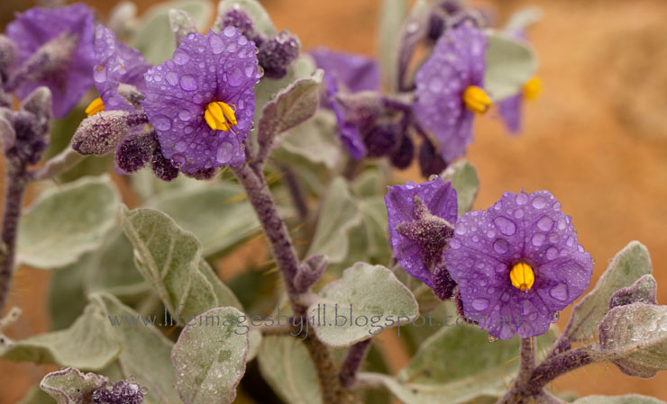
Our wildflower experience started on the first day of our trip at The Granites just north of Mount Magnet on the Great Northern Highway. Despite the rain I was out photographing this prickly character, the Flannel Bush - Solanum lasiophyllum.
  
 
From Broome we travelled north up the dirt Broome to Cape Leveque Road to go camping with friends. It was up in this region, the Dampier Peninsular, that we came across the Splendid Batchelors Buttons - Gomphrena canescens. You can see them also at the beginning of my post. I love them singularly and on mass.

 
If you saw one of my previous posts - The Boab Tree - about the Kimberley's iconic tree, the Boab - Adansonia gregorii - you would have seen this photo of the Boab flower. If not, you can click on the link to check out my post.  I had never seen a Boab flower before, but a few trees were flowering in Broome.


One of my favourites since our first trip north 30 years ago - the Mulla Mulla - Ptilotus. Widespread in arid and semi-arid areas, there are about 100 species in the genus Ptilotus, all but one occurring only in Australia. Here photographed backlit at Purnululu. Cathedral Gorge, Purnululu


You will see the bright yellow flowers of the Kapok Bush - Cochlospermum fraseri - flowering from April to September throughout the Kimberley, particular in rocky sandstone areas. The large scented flowers are up to seven centimetres in diameter, and the swollen green fruits burst open to release silky seeds. It was the first time I had ever seen the inside of the fruit, see below, which we found on the hill overlooking beautiful Marglu Billabong south of Wyndham. 


The beautiful water lillies of Marglu Billabong. There is a bird-hide here. I've borrowed the two bird pics from my husband. The one on the left is a Brolga - Grus rubicunda - which is found across tropical northern Australia as well as southwards to north and east central regions, inhabiting large open wetlands, grassy plains, coastal mudflats and irrigated croplands. There courtship dance involves an elaborate dance. You can find out more here - Birdlife Australia.

Another birding site for Wyndham - Birding WA


And yes in the second picture can you see a crocodile in the background behind the White Egret. This is a salt-water crocodile. Yes, they do eat people, so definitely one you don't want to get near, and the reason why the bird-hide is enclosed in heavy-duty wire mesh. In case you can't see that croc....


Back to wildflowers...

Below is the Sticky Kurrajong - Brachychiton viscidulus - also known as the Kimberley Rose, or by the Aboroginal names darlab or djalad. We saw many of these along the Gibb River Road and also at Mt Elizabeth Station. Flowering from April to December the spectacular red flowers appear after the leaves have dropped. There are male and female flowers on the same plant, attracting large numbers of nectar-feeding birds. They usually grow in sandy area on hills and amongst sandstone and basalt rocks.  


 I confess I had never heard of the flower below before this trip - the Bat Wing Coral Tree - Erythrina vespertilio. The pea shaped scarlet flowers are produced along 30cm racemes and appear when the tree is mainly leafless during winter and spring.  There was a huge tree near the access gate we went through on the way to Mornington Wilderness camp about 90 kilometres south of the Gibb River Road. There was a flock of Red-Collared Lorikeet - Trichoglossus rubritorquis - chattering noisily as they enjoyed the blossom.

I love the unexpected nature of wildflower photography as you never quite know what you will find and it is thrilling to find varieties you haven’t seen or photographed before, especially the rarer species.


And below is Rosella - Hibiscus sabdariffa -  a species of Hibiscus. The petals of this plant, which are very high in Vitamin C, can be made into jam. They have a delicious sour-sweet taste. This was another plant that I had never seen before, though I had tasted the jam made by a local friend - delicious! I would love to see if I can grow this at home. We saw these plants near the Barnett River just off the Gibb River Road and at Mt Elizabeth Station. More info on the Rosella plant here - Green Harvest


I hope you have enjoyed these few wildflowers of the Kimberley. So much red! But then that is the colour of the Kimberley dirt. I have many more wildflower photos to share with you soon. In the meantime you might like to visit a couple of my posts (see the links below) where I give you a few tips about photographing wildflowers. But my most important tip is - get out there with your camera! 


Taking wildflower photos doesn’t need to be complicated. Slow down, think about your camera settings, choose the best specimen, and think about composition, orientation and how you want your photo to look. Are you going to get in close or take a wider view? Do both, and take photos from various angles. Set your aperture according to how much depth of field do you want. Remember small numbers ie F4.6 equals shallow depth of field with a soft blurred background.

Photographing Wildflowers 
How to take great wildflower photos 


Thank you so much for stopping by. I value your comments and look forward to hearing from you. I will try to visit your blogs in return. Have a wonderful week. 
I am linking up to the link-ups below. Please click on the links to see fabulous contributions from around the world - virtual touring at its best!