The Wool Wagon
Pathway is one of three self-drive outback pathways in Western Australia's Gascoyne-Murchison area.
The other two outback pathways which can be explored are the Kingsford Smith Mail Run and the Miners
Pathway.
During July a
couple of years ago we explored part of the 1248 kilometre Wool Wagon Pathway
which takes travellers through the Murchison and Gascoyne's outback and pastoral country.
I recently had my
article about the Wool Wagon Pathway published in On The Road magazine, and so
I thought I would share some of the fascinating history and the stories of the
pioneers, graziers, blade shearers, horsemen, drovers, fencers and well
sinkers, and the remarkable men and women who pioneered this country which
supplied quality wool to London, which you can learn about at the interpretive
sites along the way.

The official
start of the pathway is at Geraldton on the coast, but of course you can join
it at other points along the way.
Our first stop,
100 kilometres from Geraldton was Mullewa which was one of the first Murchison
townships. Mullewa’s main attraction is Our Lady of Mount Carmel Church, built
in the 1920s by the architect-priest Monsignor John Hawes, and one of fifteen
churches built by Hawes between 1915 and 1939, which can be explored on the
Monsignor Hawes Heritage Trail. Built in Romanesque style typical of Italian or
Spanish village churches, the church was built with help from local farmers
carting stone from a nearby quarry. You can also visit the former home of
Monsignor Hawes, now the Priest House museum.

Our next stop is
the tiny township Pindar, 30 kilometres from Mullewa. Visitors flock to this
area in spring to see the carpets of everlasting wildflowers and the unique
wreath flower, Leschenaultia macrantha, which can be seen in yellow
sandy areas around ten kilometres north.

 |
| Paper Lily-Laxmannia grandiflora |
From Pindar we
travelled north, stopping at various sites before arriving at the remains of
the Wooleen Woolshed, # 6 on the trail. Once listed by the National Trust
of Australia (WA), it was unfortunately blown away by 150 kilometre winds in
2004. Built in 1922 by Alf Couch, its outstanding feature was the self-supporting
curved 80 by 25 metre corrugated iron roof, a technique perfected by Couch
because timber was in short supply. This barrel-vaulted roofline became
characteristic of sheds in the Murchison area and can be seen at the adjacent
cookhouse.
Below you
can see the remains of the woolshed, an old image of the woolshed, the
cookhouse, and an image of the inside ceiling of the cookhouse.

In the Murchison
area you have three choices of accommodation, nearby at Wooleen Station which
offers seasonal bush camping and station stays, the Murchison Oasis Caravan
Park, or free camping at Errabiddy Bluff just north of Murchison.
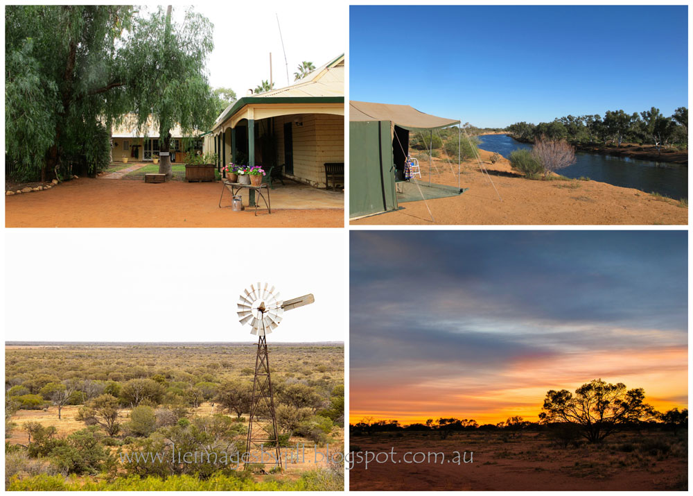
Below you can see some of Wooleen Station. We were lucky to be able to secure a
riverside camp. For more information about Wooleen and the amazing work they are doing regenerating the land, you can go to my
previous post here - Murchison
River Camping at Wooleen Station

 |
| One of the Mulla Mulla varieties |
Murchison
Settlement is a convenient overnight stopping place, particularly if you
require power and want a hot shower. There are powered and unpowered
sites, as well as motel units. You can buy fuel, a few basic supplies and meals
at the roadhouse. The second weekend in July is the highlight of their
calendar, the Murchison Polocrosse tournament, a weekend of fast action and
teamwork between riders and horses.
If you prefer a
free quiet overnight camp, the turnoff to Errabiddy Bluff is only one kilometre
north of the Murchison Settlement on the Carnarvon-Mullewa Road, then about twelve
kilometres via a sandy-gravel track to the Bluff, 4-wheel-drive recommended,
care needed during wet weather. There is plenty of room to set up camp on the
flat cleared area within walking distance of the Bluff, but very little shade.
There are no facilities and no marked path up the Bluff, but it couldn’t be
more peaceful camped under the huge canopy of stars.

On the way, stop at Errabiddy Outcamp and read the remarkable
story of Mary and James Watson who lived at this isolated outstation in the 1920s.
# 7 on the pathway.
Continuing north,
Number 10 site on the Pathway is Murchison Gate. Cattle grids are common across
outback roads today, but in the early days of pastoralism grids did not exist
and travellers were forced to continually open and close gates.
With nearly 100
gates on the road between Mullewa and Gascoyne Junction, this was a tiresome
job, so truck drivers worked in convoy. The first driver would stop and open
the gate, the trucks passed through, the lead truck closed the gate and joined
the back of the convoy. The new lead truck would open the next gate, and so on.
At this site, you can read the fascinating story of Peter Gurache and his gate
opener Emperor Hamlet.

Site 11 is Stock
Route Well # 19. Restored in June 2007, the well is one of 52 wells dug
in 1895 along the dry remote Mullewa to De Grey Stock Route, along which
thousands of cattle and sheep were driven. Lined with stone, and equipped with
troughs, buckets and a windlass or whip lever to raise the water, these wells
were capable of watering 3000 sheep or 300 cattle at one time. Wooden
fences were erected around the wells to protect them from being trampled by
thirsty stock.
Approximately 150
kilometres north of the Murchison Settlement is Bilung Pool, part of a
tributary of the Wooramel River. Known as Birlungardi by the Wajarri Aboriginal
people, this natural water feature holds water year round. These water courses
were important for early inhabitants, animals, and drovers on the De Grey Stock
Route. This is a pretty place to stop for lunch.

Gascoyne Junction lies in the heart of the Upper Gascoyne
Shire, 282 kilometres from Murchison, at the junction of the Lyons and Gascoyne
Rivers. Established in 1897, Gascoyne Junction is a centre for mining, pastoral
and merino wool industries and is good place to stock up with supplies. The
Gascoyne Junction Pub & Tourist Park offers cabins, powered and unpowered
sites. Roads in this region can flood during heavy rain, stranding motorists
and Gascoyne Junction has been virtually washed away by huge river floods
several times, most recently in 2010.
Our next stop was Site 16, the Cobbled Road. In the early
1920s all transport through the region was with camel or horse drawn wagons on
rough dirt tracks pushed through the scrub. It was an arduous process and
carters were often bogged, sometimes for weeks beside the track. In the
1930s Great Depression, labour intensive public works programs were created
using sustenance labour. Men were given work depending on the number of
dependent children – for instance four children equalled four weeks work.
The road between Carnarvon and Bangemall was ungraded using locally sourced
white rocks creating a cobbled road.

Thirty kilometres north was our next destination, the
magnificent Kennedy Ranges. Twelve kilometres in, the Department of Parks and
Wildlife (DEPAW) campground is nestled beneath the 100 metre red rock ramparts
soaring above the surrounding Lyons River valley plains. Campsites and
amenities may be basic – long drop toilet, no power or showers, and bring your
own everything, including water – but this is more than compensated by the
setting. I recommend a two or three day stay.
The Kennedy
Ranges runs north south for 75 kilometres and up to 25 kilometres wide. The
southern and eastern sides have eroded over millennia to form spectacular
cliffs, cut through by a maze of steep-sided canyons, surrounded by dry red
sand country dominated by spinifex, supporting 400 plant species including 80
species of annual wildflowers which flourish in August and September after good
rains.
There are several
walk trails. Please check the information boards at the start of the walk
trails for distances and degree of difficulty. Most of the trails have only
basic trail markers. Some follow creek lines and are quite rocky requiring a
fair amount of clambering so walkers need to be aware of their own capabilities
and the approximate time to allow.
Please click here to read my previous post about the Kennedy Ranges - Exploring
the Kennedy Ranges
From here you
continue north from Kennedy Ranges via Ullawarra Road following the Pathway
signage. You cross over the Tropic of Capricorn and reach the North West
Coastal Highway and the bitumen at Barradale rest-stop, which is a good free
overnight stop.
Alternatively you
can stay at Emu Creek Station which offers flat, shady, unpowered campsites 20
kilometres from the highway. Here you can visit the old Nyang shearing shed, #
21 on the trail.
From Barradale it
is 205 kilometres to Exmouth, all on bitumen. Skirting the bottom of Exmouth
Gulf, via Burkett Road, you turn onto the Minilya Exmouth Road which runs
parallel to the rugged Cape Range. Interesting stops include a termite mound,
the Krait Z-Force and Potshot memorials, and Charles Knife Canyon with views
over Exmouth Gulf.
Exmouth has all
facilities and accommodation you would expect, as well as being gateway to the
amazing coral gardens of the Ningaloo Reef and the dramatic gorges of the Cape
Range National Park.
Here is a pic of North West Cape with the Ningaloo Reef beyond.
The Wool Wagon
Pathway is just one of three outback pathways in the Gascoyne-Murchison area.
Also to be explored are the Kingsford Smith Mail Run and the Miners
Pathway.
QUICK FACTS:
The Pathway can
be driven in either direction, starting at Geraldton in the south, through
Mullewa, the Murchison Settlement, Gascoyne Junction and the Kennedy Ranges to
Exmouth, or start at Exmouth and travel south. The roads are mostly good
unsealed gravel but 4-wheel-drive is recommended particularly if there has been
rain. I suggest allowing one to two weeks.
WHERE IS IT?
: The trail starts at Geraldton, 417km north of Perth, Exmouth is 1,270km
from Perth.
DISTANCES:
Geraldton to Mullewa: 98km, Mullewa to Pindar: 30km, Pindar to Murchison
Settlement: 227km, Murchison to Gascoyne Junction: 298km, Gascoyne Junction to
Kennedy Ranges: 42km, Kennedy Ranges to Exmouth: 471km
BEST TIME TO
TRAVEL: June to September, to coincide with wildflower season. Avoid
summer months as temperatures can reach over 40 degrees
ADDITIONAL
INFORMATION:
Following the
trail is easy with distinctive Wool Wagon Pathway signs at main road
intersections and interpretative signage at the main places of interest.
This is remote travel, so please make adequate
preparations. The pathway is mostly along unsealed good gravel roads with some
minor sections of corrugations if not recently graded. 4-wheel-drive is
recommended. There are no services between Gascoyne Junction and Exmouth.
Supplies and services are limited and road conditions can vary, so plan ahead,
stock up on food, water and fuel, make sure tyres are in good condition and
contact local visitor centres for up-to-date track information. This is
unfenced grazing land, so please be aware of possible stock or wildlife on the
road.
 |
| Mulla Mulla |
WALK TRAILS:
Please take note of signage and be
aware of your own physical ability. Avoid walking in the hottest part of the
day, don’t walk alone, carry plenty of water and food, wear a hat, sunscreen
and good walking boots. Even on a cool day it can become very hot particularly
with radiated heat bouncing off the rocks.
USEFUL REFERENCES:
Colour Guide to Spring Wildflowers of Western
Australia by Eddy Wajon - Wajon Publishing
Gascoyne Murchison Outback Pathways by Samille
Mitchell – Mid West Development Commission
 |
| Everlastings along the Wool Wagon Pathway |
Thank you so much
for stopping by. I hope you have enjoyed this little look at the Wool Wagon
Pathway. It is cold and wintery at the moment where I live in the south west, and I enjoyed going back over my warmer travels for this blog post. I hope you did too. I value your comments and look forward to hearing from you. I will try
to visit your blogs in return. Have a wonderful week.
I had a lot of trouble with the font in this post and had to revert to writing it into a word document and then posting it into the blog. Frustrating. Have you ever had that problem? Perhaps I should just do that next time to save my sanity! Anyway, enjoy!
I am linking up to the link-ups below. Please click on the links to see
fabulous contributions from around the world - virtual touring at its best!
Life in Reflection
Hello there! I love reading your comments. Just click down here to comment too!