Hi everyone, I hope you and yours are doing well. Today is a public holiday in Western Australia - WA Day - a day where we celebrate everything that is amazing about our state. Keep scrolling down to read this week's follow up from last week's Denmark (Western Australia) post.
Below is a map of Australia. The yellow third on the left is Western Australia (WA) - the largest state in Australia, occupying approximately one-third (32.9%) of the continent's total land area. Its landmass covers roughly 2,527,013 square kilometers (975,685 sq mi). In comparison, the total land area of Australia is around 7,688,287 square kilometers.
WA is a state of contrasts - from rugged remote landscapes in the north, through grass-plains, savanna, and deserts in the central part, to farming land and forests in the south. Boarded by the Indian Ocean, I've brought you blogs of these landscapes many times in my blog. In the Index you can see a list, or go to the search box. I love Western Australian in all it's guises.
Today - forests. I've marked Denmark on the map above - down in the south west corner. Today I am following up from last week's post and taking you back to Denmark and we will make a day trip travelling through the amazing karri forests to the sea.
From Denmark we drove out along Scotsdale Road to Harewood Forest - only about 10 kilometres from Denmark.
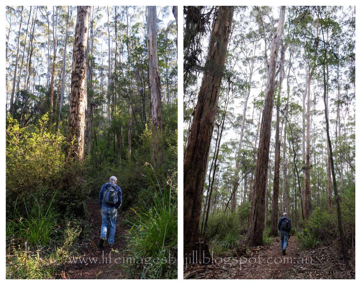
Heavily logged for timber in the late 1800s, Harewood Forest is a great example of forest regrowth, and is a lovely place to bushwalk. The loop walk trail is only 2.8km, but it can be slippery when wet and there are steps and hilly parts as it winds upwards through the forest. In cooler months my recommendation is to take a rain jacket, as it was sunny when we set off, but we only got half way along when it started to rain. Unfortunately all we could do was put our head down and walk as quickly as we could back to the car. There wasn't anything flowering but I still enjoyed taking photos of the forest.
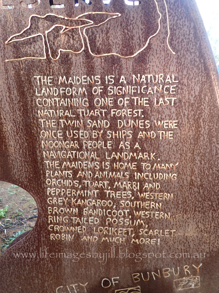
There are information plaques along the way telling you some of the history and about some of the plants.
Walking through the beautiful Harewood Forest along the
banks of the Scotsdale Brook, it
is difficult to imagine its past. The
Karri trees tower straight and tall above you, forest flowers bloom in
profusion in season, and the sound of bird song fills the air. It is a peaceful world. The trickling brook
and picnic tables invite you to linger and spend time enjoying the forest. There are mossy logs and tiny fungi to find - though make sure you have your camera on the right settings for low light. (smile)
Interpretive signage along the walk tells us that the
Harewood Forest Conservation Area is a pocket of forest that has regenerated
after being clear felled by hand with axes and cross cut saws as part of a 20,000
acre timber lease acquisition by Millar’s Timber and Trading Company in 1895. At
its peak, two trainloads of sawn Karri timber per day were sent to Albany for
export all over the world. Karri blocks were used to pave streets in London.
After 10 years of intense logging all the usable timber was used. The mill
closed in 1905 and Denmark was only saved from demolition by the petitioning of
locals.

During the 1920’s Western Australia offered free land to
settlers from the United Kingdom under the group settlement scheme. Fifteen settlements were set up in the area,
one of them in the Harewood area. However
many of the immigrants had no background in farming or living in primitive
conditions and by 1930 70% of the settlers had left the Group Settlements. For those who remained the life was tough.
But the resilience of those early settlers and those who came after paid off, as seen in the vibrant, diverse community that Denmark is today within a beautiful natural environment. And we can enjoy the beauty of the area, such as in Harewood Forest.
A few photos before the rain.... I'm sorry I don't have more to share... the rain you know.... and my camera not on the right settings for low light. (note to self!)
The green plant top left above is the tassel flower - Leucopogon verticillatus - endemic to the south west of Western Australia.
Western Australia’s southern forests are dominated by Karri trees (Eucalyptus diversicolor))which grow only in WA’s wettest corner. Belonging to the eucalypt family, many of the Karri trees are over 400 years old. Reaching a maximum height of about 90 metres they are one of the tallest forest trees in the world. Karri’s are easily identified. Their long straight trunk has a smooth bark which is shed every year, and changes colour as it matures. Interspersed with the Karri are Tingles, Jarrah, Marri, Bullich and Blackbutt and a stunning display of over 1500 wildflower species from September to November.
Karris are one of my favourite trees. It is an amazing world to wander through in quiet contemplation of their height and age and resilience.
Shedding bark
From Harewood Forest we drove out along Mt Lindesay Road to the base of the Mt Lindesay walk trail. 23 kms north of Denmark, take care and watch out for kangaroos, and the last part of the drive is a narrow sand/gravel track.
The 10km walk trail to the summit of Mt Lindesay (385 metres above sea level) is a class 4 trail (challenging), allow 4 hours. We did it many years ago when we were much younger. Make sure you carry water, food, wear a hat, and be prepared for changing weather, and let someone know where you are going and when you expect to return.
The first 500 metres is a steep track, then an easier grade, before arriving at a granite outcrop. There are magnificent views from the top. You can see some photos from Trails WA here - Mt Lindesay. There is also a link to save the trail to your mobile phone which can be used offline - very useful when you are doing the trail.
Here is a photo I top from the top in 1980 - just to prove I did do it. The photo hasn't retained its colour unfortunately. My husband carried our young child up when we did this climb. We were much younger and fitter.
There is a information shelter and toilets at the start of the walk trail. We walked a little way out down to the bridge across the Denmark River, and then went back to the car to have our picnic lunch.... in the car as it started to rain again.... that's Denmark weather for you.... Probably because of the weather, we had the place to ourselves.
Below is a view of farmland at the base of Mt Lindesay, and a view of Mt Lindesay from the other side of the farm.
From Mt Lindesay we drove back out along Scotsdale Road, then down McLeod Road
and Lights Beach. It was blowing a gale! Certainly not a day for swimming - but very popular in summer and bluer than blue. I've included contrasting winter and summer images
Despite the weather we had a lovely day. It was so nice to get out in the forest, even with the rain. We have been going to Denmark for over 50 years as I have family living there. It has changed a lot in that time, but I still love it. It is one of my favourite places in Western Australia.
I hope you have enjoyed this look at Denmark forests by the sea.
You might also like:
More information about the walk trails at:
Explore Parks-Harewood Forest
Trails WA-Mt Lindesay walk trail
Western Australian Giant Trees - karri
Thank you so much for stopping by. I value your comments and look forward to hearing from you. I will try to visit your blogs in return. Have a wonderful week.
I am linking up to the link-ups below. Please click on the links to see fabulous contributions from around the world - virtual touring at its best!
If you are looking for a translate button - it's there near the top on the right hand side.
Hello there! I love reading your comments. If you scroll down to the bottom you can comment too! I would love to hear from you.
Until then, enjoy your day...Life only comes around once, so do what makes you happy and be with people who make you smile.


.jpg)